Manhattan Community Board Seeks Federal Funds to Straighten Out Hudson River Greenway

They want to tear down switchback mountain.
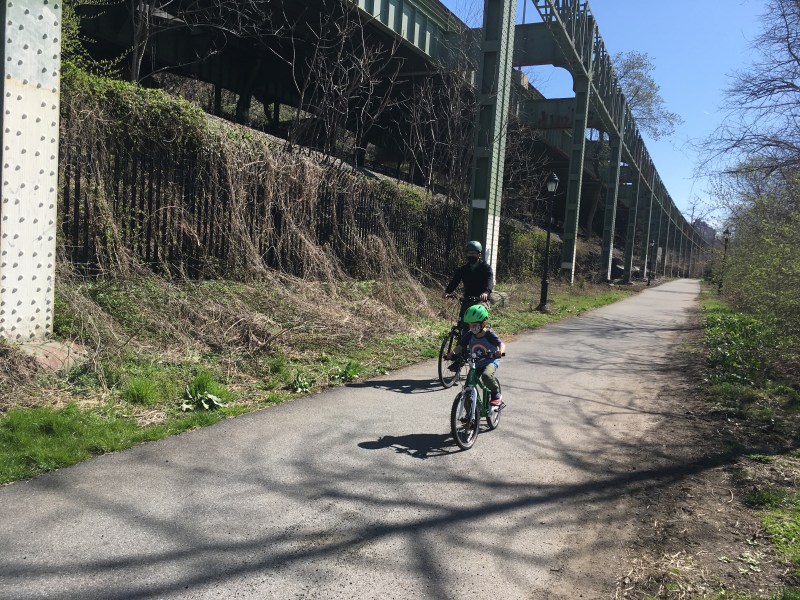
Manhattan Community Board 12 is asking the city to use federal infrastructure money to straighten out a notoriously tricky stretch of the Hudson River Greenway north of the George Washington Bridge so that cyclists no longer have to mount a treacherous switchback under Washington Heights.
The Feb. 7 letter asked to Parks Department, which manages the greenway, and the city’s Office of Intergovernmental Affairs to fight for federal infrastructure funding for a path the board calls “the Lighthouse Link,” a concept to connect a missing greenway gap starting near the landmarked Little Red Lighthouse underneath the George Washington Bridge and ending at a dead end loop near West 187th Street (see below).

Currently, the portion of the Hudson River Greenway just north of the George Washington Bridge connects, via a steep winding hill to a stretch further north along the Henry Hudson Parkway, because the path directly north simply runs out of room when it reaches the lighthouse, leaving nothing but a rocky shore to contend with. Any construction that filled in the gap then, would most likely have to be a platform built above the Hudson River.

The letter from the community board says that the board voted 40 in favor, 1 abstention, 1 non-vote and zero people against “urging the New York City Department of Parks and Recreation and the Mayor’s Office of Intergovernmental Affairs to prioritize this project and request federal funding to complete it.”
Neighborhood activists who want to see the path straightened out so that the greenway would connect to a dead end path further north in the park near 187th Street say that the current uphill switchback keeps all but the hardiest cyclists and pedestrians from heading north on the greenway.
“It’s not just it’s not just a danger for bike riders, it’s also people who are walking, people with wheelchairs, people with kids,” said longtime Inwood environmental activist Maggie Clarke. “Generally, a lot of people, unless you actually live further north, if you’re coming from the south, you get you see the hill at the lighthouse and you go, ‘Okay, I’m turning around now.'”
But because the northbound path currently turns into a drop onto a rocky shore next to train trucks owned by Amtrak, there isn’t an easy way to build out the bike path on the existing ground. That means the the city would need to build a platform path on the water itself, the kind of plan that Clarke said the city has kicked around a few times but has always been seen as prohibitively expensive with its own money. As the letter from the community board points out, the path “has been a CB12M Capital Budget priority for years, but has never been funded, due to its expense, estimated to be in the tens of millions of dollars.”
But a similar gap in the greenway has been filled in before, specifically a Bloomberg-era project that connected West 83rd Street and West 91st Street, one that was paid for in part with federal money. And with “an effing lot of money” coming to the city for safe street and bike programs, Clarke said that the time is now to start straightening out the path.
“This is probably our best chance to get this done. If we don’t succeed, it may never be done until the next time, there’s an infrastructure bill. And we may be dead by then,” said Clarke.
The letter also asks Amtrak to grant an easement for the construction of the path. The rail provider said that while it hasn’t been presented with a plan for a path to fill in the gap, it’s not opposed on principle to the idea.
“Amtrak has not been presented with a formal proposal to utilize any Amtrak property in order to construct the half-mile long link between the disconnected sections of the Greenway’s riverside trail path, just north of the GW Bridge,” said Amtrak spokesperson Jason Abrams. “In this location, the narrow Amtrak railroad right-of-way, which supports many trains per day operating at high speeds, is directly adjacent to the Hudson River shoreline. Amtrak would be happy to work with the City and community groups to find a design solution to allow the trail’s connection in this, clear of the minimum train operations safety envelope.”
Even at a big cost, Clarke argued that a straightened out greenway could provide economic benefits for the area, making it easier for people coming from the south to get to Dyckman Street restaurants and attractions in northern Manhattan like The Cloisters. Getting rid of the switchback is also part of a larger vision that Clarke has helped push to create a more unified bike network in the area by adding a Brooklyn Bridge-style protected bike lane to the upper level of the Henry Hudson Bridge, which she said would create a safer and easier path between the west Bronx and upper Manhattan than the route over the Broadway Bridge.
“It’s part of a larger vision which could get people well into the Bronx, well into Riverdale. And likewise, people from Riverdale to commute or exercise down towards you know downtown. Right now the only way to get from say Riverdale to Inwood or vice versa is across the Broadway Bridge, which is a dangerous bridge and the approach in you know, from the north, you have to climb up a serious Hill, and there are buses, because there’s a bus depot on the inward side. It’s also very close to four sanitation depots, so a lot of garbage trucks are coming through there. It’s a very, very hairy link,” she said.
The proposal to push the project out front for federal funds hasn’t been seen by Parks yet, but a spokesperson said the agency will respond once it gets a look at it.
“When received, we will review the proposal and respond directly,” said Parks spokesperson Crystal Howard.
Clarke and CB12 have additional support from bike advocates in the city, who asked the Adams administration to start drawing up plans for the missing link ASAP.
“Nobody likes a missing link, especially on greenways!” said Bike New York Director of Advocacy and Communications Jon Orcutt. “It would be a great step for the Adams administration to get the Inwood Hudson waterfront link underway as soon as possible.”
