Mapping Out a Route for the Hudson River Greenway in the Bronx

In 1991, Governor Mario Cuomo signed the Hudson River Valley Greenway Act, setting in motion the design and construction of a continuous walking and biking route along the river, from Manhattan to Saratoga County. More than two decades later, the New York Metropolitan Transportation Council — the NYC-area regional planning agency — has come up with a preferred route for the greenway through the Bronx and parts of Yonkers, which would fill the gap between the Manhattan Waterfront Greenway and the Old Croton Aqueduct Trail in Westchester County.
The study, funded by a $1 million earmark from Senator Charles Schumer in the 2005 federal transportation bill, involved years of workshops, meetings, and analysis by NYMTC and lead consultant The RBA Group to identify a route. Tweaks are still being considered, and NYMTC anticipates ironing out the final details by the middle of next year. This study, while comprehensive, simply outlines a preferred route and provides cost estimates. Bronxites looking to walk and bike on their section of the greenway are still a long way from seeing shovels in the ground.

The route, running from the Henry Hudson Bridge to Yonkers, is broken into three phases, covering the next three years, the next decade, and beyond.
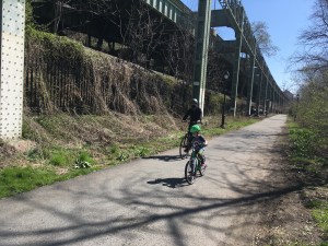
The first phase creates a physically-separated greenway path along Palisade Avenue and in Riverdale Park between 232nd and 254th Streets. North of 254th, it would create an on-street route along Palisade Avenue, 261st Street, and Riverdale Avenue to Yonkers. South of 232nd, an on-street route is planned along Palisade Avenue and Kappock Street to the Henry Hudson Bridge.
At last month’s Community Board 8 parks committee meeting, residents of Palisade Avenue raised concerns about the potential changes. Currently, the street, which carries two-way traffic and has on-street parking on its east side, does not have any lane markings. The report recommends building a sidewalk along the west side, striping a yellow centerline and adding shared lane markings for cyclists, while maintaining on-street parking.
Residents at the meeting were worried that sidewalk construction would require land takings and alter the wooded, alpine nature of the area. NYMTC is considering other options, including a painted area on the street that designates pedestrian space instead of a sidewalk. “We understand the residents’ concerns about the bucolic nature of the roadway,” said Gerry Bogacz, NYMTC’s planning director. Some residents requested that the plan relocate the greenway’s on-street route one block east to Independence Avenue, but Bogacz was less receptive to that idea.
To the north, the proposal calls for a new greenway path along the river from the Riverdale Metro North station to Ludlow Street in Yonkers, to be built within the next decade. A later phase would extend the waterside greenway south from Riverdale station to 232nd Street. Although the ultimate goal is to get the greenway route as close to the riverfront as possible, the plan assumes that cyclists will use an on-street route starting at 232nd Street to climb the hill and connect with the Henry Hudson Bridge.

Today, cyclists looking to go from Inwood to Riverdale must use the Broadway Bridge, which prohibits cyclists on the sidewalk, instead requiring them to ride on a steel-grate roadway with two lanes of traffic in each direction. A path on the west side of the Henry Hudson Bridge’s lower level offers a safer option, but the MTA requires cyclists to walk their bikes across the bridge. (Since the implementation of cashless tolling on the bridge last year, there are no longer toll booth agents on site regularly to enforce this rule.)
On the Manhattan side of the bridge, the plan recommends adding ramps to stairs along the greenway route in Inwood Hill Park in the short term. Over the next three to 10 years, the greenway plan envisions building a cantilevered path on the Henry Hudson Bridge’s west side that will be wide enough to accommodate a two-way bike path.
Amtrak’s swing bridge at the mouth of the Harlem River would provide an even more direct waterfront route than the Henry Hudson Bridge, but negotiations with Amtrak about using the existing span were fruitless. The only possibility for a greenway along this route, the report says, would come if the bridge is replaced as part of a future upgrade to the rail corridor.
The project includes a steering committee comprised primarily of representatives from New York City and Westchester County agencies, as well as Amtrak, and a technical advisory committee comprised mostly of community institutions, environmental groups, and advocates.
Although NYMTC has released a preferred route, consultation with advisory groups continues: Next week, NYMTC staff is meeting with Bronx Borough President Ruben Diaz Jr. Last month, Bogacz gave a presentation to CB 8’s parks committee and hopes to go before the committee again in February before receiving final comments from the board in May. After funding for consultants runs out at the end of this year, NYMTC staff will be responsible for additional changes before the project wraps in mid-2014.
After that, implementation is up to the agencies that manage property along the greenway route, including the MTA, Amtrak, NYC DOT and the Parks Department. Bogacz said NYMTC will be able to help identify funding sources and, as with all regional transportation funding decisions, will coordinate projects in regional transportation plans if implementing agencies pursue them.
The concept plan’s recommendations, including changes in Inwood and Yonkers, are estimated to cost $110 million and to be implemented piecemeal over at least a decade. The biggest-ticket items are an estimated $30 million for the cantilevered path on the Henry Hudson Bridge and and an estimated $20 million for a greenway path between the river and the railroad from Riverdale station to Yonkers.
“It would be a complicated undertaking to implement this,” Bogacz said. “The biggest part of that is funding.”