Sooner or Later, the Brooklyn-Queens Waterfront Needs Better Transit

The Brooklyn and Queens waterfront is in the midst of a grand transformation that’s only just begun. Newly built Brooklyn Bridge Park is already firmly established as one of the city’s most stunning public spaces. The Brooklyn Navy Yard now hosts glitzy fashion shows by international designers like Alexander Wang and Dior. Long Island City’s waterfront is a wall of glassy new condos. Many more changes are coming.
As this transformation takes place, new travel patterns are emerging, and for the better part of the last ten years, planners have floated the prospect of a new transit line along the waterfront to accommodate residential development and job growth. Most recently, architecture critic Michael Kimmelman suggested in the New York Times that the city build a streetcar along the waterfront, prompting Alicia Glen, the city’s deputy mayor for economic development, to Tweet: “Love big ideas.”
Others were critical, noting that a streetcar represents a huge investment that could be better spent on other transportation priorities: using buses to connect residents with the subway, or beefing up service on the city’s busiest bus routes. Writing for Next City, Stephen Smith noted: “You cannot effectively connect waterfront neighborhoods in Brooklyn and Queens to both each other and the subway.” Smith also pointed out that the waterfront neighborhoods, for all their development, have relatively low population and job densities.
To plan for the future of the waterfront, however, we have to give some thought to transit. I agree that the cost of a light rail line is unnecessary (and streetcars make little sense regardless of the expense), but the city will need to forge stronger transportation links to meet the area’s full potential. The rationale for transit improvements is about the waterfront’s ultimate potential for new housing and jobs, rather than the existing conditions.
The city should begin by strengthening bicycle connections and by improving bus service with the goal of a one-seat ride from Astoria to Downtown Brooklyn. Both modes could certainly connect new residents and workers with the subway: The F train at Jay Street and the 7 train at Vernon Boulevard-Jackson Avenue are both within reach.
But a subway connection is not the main point. A successful vision for the Brooklyn-Queens waterfront is necessarily oriented away from Manhattan and instead looks to stitch the waterfront communities together. Otherwise, new residential developments will be effectively cut off from each other and from new job centers in DUMBO, the Navy Yard, Williamsburg, and Long Island City.
The transformation of the waterfront witnessed up until now is really just the beginning. Several mega-projects are planned for the Brooklyn-Queens waterfront that will ultimately add up to 16,000 new housing units. More than 3,000 new units of housing are set to rise along the Astoria waterfront, on an isolated peninsula just south of the Triborough Bridge. Other mega developments are planned at Hunter’s Point South (up to 5,000 units), Greenpoint Landing (5,500 units), and the Domino Sugar factory at the base of the Williamsburg Bridge (2,300 units).
The Brooklyn-Queens waterfront also holds tremendous economic potential, and city leaders hope that it will continue to attract new employers in technology, design, and media. Over the past 10 years, employment in and around the Navy Yard has climbed by 2,000 jobs, or 21 percent, and by 9,000 in DUMBO and Downtown Brooklyn. Brooklyn’s economic boosters imagine this growth will accelerate. The borough’s “Tech Triangle” plan projects that employment in DUMBO, the Navy Yard, and Downtown Brooklyn will double over the next few years. The purchase of the former Watchtower buildings in DUMBO and the expansion of Etsy indicates that these predictions should be taken seriously.
In Queens, borough leaders hope that the new Cornell-Technion campus on Roosevelt Island will lead to new business growth in Long Island City, with Vernon Avenue and 21st Street among the potential corridors for new tech-related businesses. This vision is still in its infancy, but a waterfront transit line could serve to anchor new business growth.
Currently, there are few viable transit options for people who wish to travel along the waterfront. The G train has a role to play, but it won’t be sufficient. It is too far from the New Domino development, which will add 500,000 square feet of office space to the area, and from the Navy Yard. It misses the Long Island City and Astoria waterfront completely.
Ferries will also play a role. The East River Ferry has been running for three years and has built up a modest ridership of residents and tourists. In response to the new development planned at Astoria Cove, the city commissioned a $500,000 study on the feasibility of extending service to Astoria. But the East River ferry runs only once every 20 minutes at rush hour and once an hour during non-peak hours. Plus, many questions remain about the ferry’s long-term viability. Information on ridership and the amount of city subsidy required to keep the ferries running is frustratingly obscure.

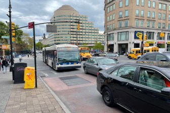
Improving bus service is the logical first step. Currently you would have to take four buses to get from Astoria Cove to the Navy Yard. One of them, the Q103, runs only once an hour and not at all on the weekend. Another, the B32, runs only once every half hour. Infrequent service may be the reason that existing ridership on these lines is so low. The short-term goal should be a one-seat bus ride from Astoria to DUMBO and through to Downtown Brooklyn. Buses should arrive once every 10 minutes or less during peak hours. This represents a relatively minimal investment, but one that should be closely monitored to see if ridership is sufficient to upgrade service to bus rapid transit.
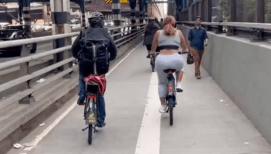
The city should also strengthen bicycle infrastructure along the corridor and extend plans for the Brooklyn Waterfront Greenway into Queens. Bike lanes along Flushing Avenue, which runs past the Navy Yard, are already among the city’s most heavily-used. Expeditiously building out the greenway and projects like the Pulaski Bridge bike lane upgrade will fill gaps in the bike network, especially between Greenpoint and Long Island City. More bike-share stations along the length of the waterfront would also help fill the gap between a new transit line and points inland.
Residential development will most likely continue along the waterfront with or without a new transit line, but improving transportation options is important for several reasons. It may be necessary to foster economic growth on the scale that city leaders are hoping for. Linking growing job centers with a new transit connection can catalyze even more business growth. And a high-quality transit connection along the waterfront can shape the character of new development for the better. Without better transit and bicycle infrastructure, neighborhoods will suffer as more people opt to drive and clog streets with traffic.
