New Traffic Monitoring Toolkit Can Get You Started on Street Safety Activism

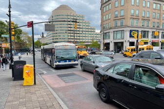
Just about every New Yorker knows off the top of their head exactly what the most dangerous intersections in their neighborhood are (for me, it’s got to be the western end of 125th Street). But what most New Yorkers don’t know is what to do about it. Now, thanks to Transportation Alternatives’ new Neighborhood Traffic Monitoring Toolkit [PDF], there’s a step-by-step guide for citizens to track traffic violations on their streets and press community leaders to improve street safety.

The guide includes tips on each step of the process, from choosing what to measure (speeding, though dangerous, is hard to measure without a radar gun) to targeting the right officials (don’t go for your police precinct’s commanding officer but his number two, the executive officer). The toolkit includes form letters for writing to your community board chair and City Council member, templates for counting traffic violations, and survey questions to pose to pedestrians walking by.

“To understand why there are so many injuries and fatalities on our streets every year, we need accurate, localized data,” said T.A. executive director Paul Steely White in a statement. “The Neighborhood Traffic Monitoring Toolkit empowers ordinary people to make their communities safer.”

Of course, the toolkit is just to get activists started; you can always contact T.A. for more hands-on assistance.

ALSO ON STREETSBLOG

Brooklyn Traffic Calming Mural Unveiled

|
Groundswell Community Mural Project and Transportation Alternatives unveiled a mural yesterday evening at Third Avenue and Butler Street in Brooklyn’s Gowanus neighborhood. Conceived by local youth and facilitated by artists Christopher Cardinale and Nicole Schulman, the ghostly, three-story tall painting pays tribute to three young boys; Victor Flores, Juan Estrada, James Rice, and the 28 […]

NYPD Starting to Roll Out Traffic Safety Data Online

|
Traffic crash data, long a closely guarded secret of the NYPD, is now slowly being released online. Pursuant to the Saving Lives Through Better Information Act, which took effect Wednesday, the department will begin posting monthly updates on summonses and crashes, differentiated by mode of travel and contributing factors and broken down by precinct and […]

Bronx Teenagers Continue Two-Year Fight For Pedestrian Safety

|
Two years ago, the Bronx Helpers decided to take action about a dangerous intersection in their neighborhood. The team of middle and high-schoolers, participants in a community service group run by the New Settlement Apartments, routinely crossed the street at 172nd and Townsend. They all could recount traffic crashes they’d seen at the corner, with […]

Crashstat 2.0 Reveals NYC’S Most Dangerous Intersections

|
Crashstat shows Fordham Rd. in the Bronx to be one of the most dangerous streets in New York City. For years, Livable Streets advocates have pushed New York City government to make citywide pedestrian and cyclist crash data more accessible to help civic groups and policy makers make more intelligent street design improvement decisions. Rather […]

This Week: Street Safety, Transit Experts, and a Trip to Albany

|
It’s a big week to get involved with neighborhood efforts to improve street safety: A community board in Bedford Stuyvesant will mull a 20 mph neighborhood speed zone, Brownsville residents will figure out where they want better walking and biking, and the Boerum Hill Association will host a traffic safety forum, followed by a Park Slope […]

Traffic Calming Mural Unveiling

|
This summer, Transportation Alternatives has collaborated with Groundswell Mural Project to honor children that have been killed by cars and trucks along 3rd Avenue and to promote traffic safety. The Groundswell project team is an outstanding youth group from the Third Avenue corridor community that has worked under the guidance of acclaimed social activist artists […]