NYC Bicyclists Get Their Own MapQuest
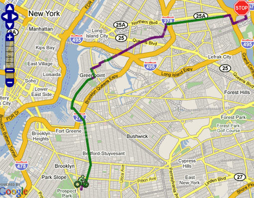
Ride the City displays streets with bike lanes in green.
The good old New York City Bike Map is about to face some stiff competition. On Sunday, three enterprising cyclists launched "Ride the City," a web site that finds the safest and most efficient routes for those on two wheels. Here’s how it works:
The concept is pretty simple. Just like MapQuest, Google, Microsoft, and other mapping programs, Ride the City finds the shortest distance between two points. But there are two major differences. First, RTC excludes roads that aren’t meant for biking, like the BQE and the Queens Midtown tunnel. Second, RTC tries to locate routes that maximize the use of bike lanes and greenways.
Once your route is determined, the mapping software provides directions and displays bike shops along the way. Though perfectly functional, Ride the City is still in the testing phase. Its creators are looking for feedback to help improve route selection, and plan to add functionality, like locating bike parking facilities, in the future. We’re no programming experts, but it seems like Ride the City could also help track the routes cyclists are riding, like Boston is doing with Google Maps.