New Tool Maps Sidewalks From the Sky — And Encourages Cities to Fill The Gaps
| | No Comments
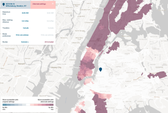
Cities across America will soon be able to easily map their pedestrian infrastructure using the power of artificial intelligence — and challenge them to have a long overdue conversation about why those networks have such an acceptable number of gaps. Now there are no excuses.