Eyes on the Street: The Dawn of a Better Brooklyn Bridge Bike Lane!
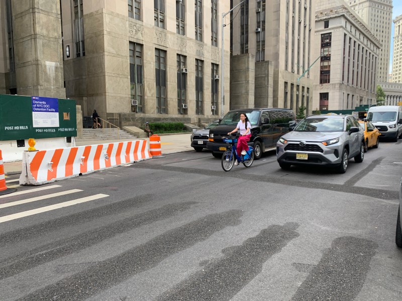
The road to nowhere is on its way to oblivion.
The city Department of Transportation has begun work on paired protected bike lanes through the tangled core of urban cycling in Lower Manhattan’s civic and court center — a project that promises to unleash the full potential of the Brooklyn Bridge bike lane for cyclists moving between the span and points north [PDF].
Westbound cyclists, not so much.
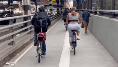
But let’s focus on the positives first. As you can see, the existing protected bike on the Brooklyn Bridge currently continues through the intersection at Chambers Street and up Centre Street until the protection abruptly ends at Worth Street:
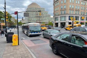
This was once, as cyclists know, one of the most notorious placard-abuse zones. Illegally, and double-parked court cars made this area dangerous for riders:

The first phase of the Brooklyn Bridge project has virtually eliminated blockages for northbound cyclists on Centre Street between Chambers and Worth and southbound cyclists on parallel Lafayette Street between Worth and Chambers.
Here’s the entire area on a map:
Currently, the stretch of Centre Street north of Worth Street is what cyclists call “The Sluice” because it resembles an entry path into an abattoir. Both curbside lanes of the roadway are occupied with placarded court and law enforcement cars. The presence of courthouses on both sides of the roadway leads to frequent double parking and, indeed, triple parking when taxis drop off passengers. It is unclear why court officers, judges and other workers get free parking privileges in this particular courthouse zone, given that it is served by close to a dozen subway stops.
Also, Corrections buses often double-park on the right side of the roadway in front of the Tombs, at the top of this recent photo from the Sluice:

We’re usually fighting for our lives in this area, so here’s a Google archival shot of how it generally looks to this day.

The slaughterhouse conditions continue northbound on Centre Street to Canal Street. But the roadway definitely does not get safe above Canal. Yes, there is less double parking, but frustrated drivers tend to speed above Canal, where Centre opens up to two wide, rarely obstructed lanes. Cyclists heading northbound to the crucial eastbound bike lane on Grand Street, or to the westbound bike lane on Prince Street are harassed and endangered.
Since January 2017, there have been 64 reported crashes on just the two-block stretch of Centre Street between Canal and Grand streets, injuring eight cyclists, three pedestrians and two motorists.
Interestingly, in the nine months since the city added the Brooklyn Bridge bike lane and redesigned Centre Street between Chambers and Worth streets, there have only been three reported crashes, injuring zero cyclists and pedestrians, plus two motorists. Over the exact nine-month period before the protected bike lane went in, there are 10 reported crashes, injuring a pedestrian and three motorists.
So what’s the plan?

Work is under way to extend the Brooklyn Bridge protected bike lane on Centre Street north of Worth Street all the way to Kenmare Square and add a downtown-bound protected bike lane on Lafayette Street south of Kenmare Square, which currently has a painted lane. Lafayette runs northbound above Kenmare Square. It currently has a one-way protected bike lane; that will will be made into a two-way protected bike lane (see graphic, right).
The DOT had hoped to do that work last year, but the stars did not “align.”
The city will cut the motor vehicle lanes on Centre Street from two down to one in the section between Worth and Canal, and had previously said it would install pedestrian island at every intersection along the way (some of those have already been blocked out).
The agency has not said what it will do to eliminate double- and triple-parking along the corridor, but the changes between Chambers and Worth show that even the placard class can sometimes get the message (in any event, their illegal parking will no longer endanger cyclists, but only congest the roadway for their fellow drivers). The DOT says the work will finish up this summer.
The Achilles heel?
The only thing missing from this gap-closing plan is a better solution for cyclists who want to ride between the Brooklyn Bridge bike path and points west, including the hugely popular Hudson River Greenway.
Currently, cyclists are directed to use westbound Reade Street, which has a painted lane that is almost always blocked by trucks or double-parked cars. And that roadway dead-ends at Greenwich Street, preventing a direct connection to the north-south greenway.
There is nothing in this plan that would change that.
