The Suburbanization of NYC’s Waterfront
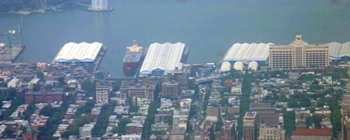
Recently, a bunch of us took a bike excursion along the East River waterfront from Carroll Gardens, Brooklyn to the new Water Taxi Beach in Hunters Point, Queens. Traffic was light most of the way and street life relatively heavy.
Though currently dominated by old industrial buildings, the thriving neighborhoods adjacent to the waterfront seem poised to reclaim and reinvent this last urban frontier. Unfortunately, many of the city’s current redevelopment plans threaten to bring deadening, one-dimensional uses to the City’s valuable waterfront.

The car-oriented entrance to Schaefer Landing, a new waterfront condo tower in Greenpoint-Williamsburg.
Much of the new waterfront development is being defined by large car drop-off areas, vast amounts of parking, passive walls and expansive "open space" — designs that deter public use and distance the new buildings from their neighbors. We are, essentially, suburbanizing our waterfront.
Similar luxury high-rise developments and elaborate design schemes are degrading urban waterfronts like Barcelona’s Diagonal Mar development and Toronto’s new highrise waterfront.
Here in New York, the new residential towers are being sold as bringing a built-in constituency to the waterfront, but they will inevitably house a small, well-heeled population intent on keeping any other constituencies out of the surrounding public spaces. The towers themselves and the large open spaces that surround them will also reinforce exclusionary goals.

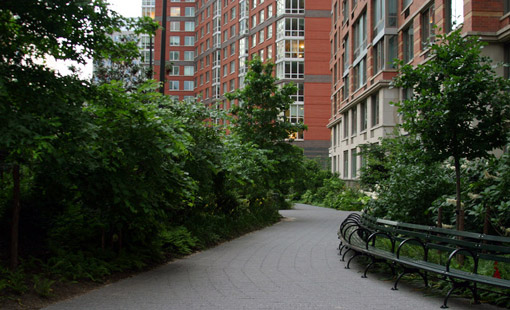
Teardrop Park is a $17 Million public park that serves primarily as a private courtyard arboretum to the surrounding high-rise development.
Even the celebrated Battery Park City does not really work for the public in the areas around the residential developments and there is really not that much to do there. The public spaces that work better there like Rockefeller Park and the plazas of the World Financial Center were put in before the high-rise residential and are extremely well managed and programmed for public outcomes. The newest part to be developed around Teardrop Park reveals that this lesson has not yet been learned.
The most recently completed suburban, "tower-in-the-park" developments include Schaefer Landing in Williamsburg and Queens West. More "luxury" residential is sure to follow with the advent of the Williamsburg-Greenpoint rezoning. The most egregious planned development is approaching finalization on what could be Brooklyn’s and perhaps NYC’s most promising waterfront stretch.

The current plan for Brooklyn Bridge Park lacks the entrances, connections and destinations of successful parks and seems designed more for the private needs of the residents of Brooklyn Heights and the planned luxury towers.
Brooklyn Bridge Park, is a development project masquerading as a park. I have recently written a more in-depth critique of this plan and the park design. Most of these efforts seem to be driven by the Empire State Development Corporation but are also supported by the city. They all are threatening to preclude public access and ownership of our waterfront while bringing more traffic and private control of public space.
The fact that the buildings are placed at the entrances to the waterfronts and the parks and are surrounded by highly-trafficked roads, car-dominated entrances and large swaths of passive green space ensures that these crucial areas will clearly belong to the high-rise residents and not the people of Brooklyn.
It does not have to be this way. Before these narrow development interests dominate the public process and public right-of-way any more than they have already been allowed to, there are copious opportunities to stake claim for more public uses and public access.

It is not too late, the face of Brooklyn can still be its front porch showcasing the character and diversity of brooklyn rather than a suburban backyard.
Looking at the best waterfronts around the world, few have high-rise residential at the waters edge and many have been able to keep some existing light industrial uses and integrate other more public uses while maintaining a financially self-sustaining model.
Will our new waterfronts become the face of our great neighborhoods, bringing more public access and public benefit, or will they resemble more suburban values with private control of land use and more car traffic?
The scale of buildings bordering a waterfront should not be towers but a continuous line of 4- to 8-story buildings that actively engage the public spaces. Towers, where appropriate, can be back from the first line of buildings. Otherwise, towers can dominate and "control" waterfront destinations. Likewise, contrary to popular belief, parks do not usually work as major waterfront destinations but can be used to connect more defined urban waterfront destinations. Many places outside of NYC offer strong models for alternative waterfront development that could easily be applied to many locations in NYC.

Vancouver’s Granville Island has many revenue-generating uses that also serve as great public space and cultural destinations, while providing very limited parking and the lowest possible level-of-service on its streets.
Vancouver’s Granville Island – This difficult to access island industrial site has become Canada’s most successful development. Run publicly and breaking even financially, the development has a full range of publicly focused uses, from artist live/work spaces that spill out on to streets, to a community center, shops and the world’s highest performing public market per square foot — and a negligible amount of housing.
Circular Quay, Sydney, Australia – a world famous urban mixed-use waterfront with many destinations, throughout, the public spaces come first.
Rhine River Promenade, Düsseldorf, Germany – A shrinking budget ended up creating a better waterfront
Porto, Portugal – A historic model of an urban waterfront as the soul and center of a city.
Miami’s Design District – This brand new district was quickly transformed from an inaccessible industrial area. It was a near immediate economic success, building itself around a pedestrian scale, with widened sidewalks, curb extensions, low residential density, and a strong 24-hour artist community.
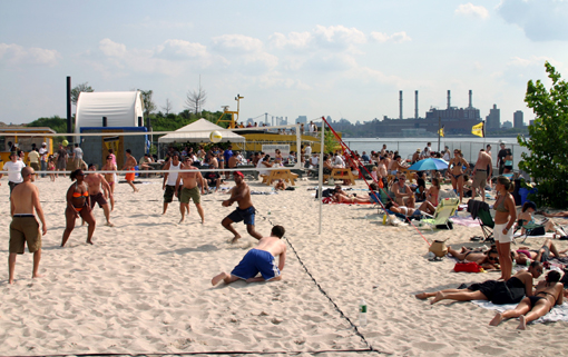
The Water Taxi Beach was of course the highlight of the trip and turned out to be a refreshingly good example of a more entrepreneurial approach to waterfront planning while maintaining a broader public purpose. It is brought to you by the same person who created Peir 63 and was involved in many of the successful parts of Hudson River Park.

The new Water Taxi Beach is open to the public and draws people from all over while costing the city nothing.