Study Says Fresh Direct Warehouse Brought More Auto Traffic to the South Bronx
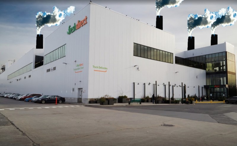
Fresh Direct doesn’t mean fresh air.
A Fresh Direct warehouse that opened in the South Bronx contributed to increased traffic congestion in two neighborhoods, according to Columbia University researchers who analyzed two years of Google map data. The findings contradict an environmental assessment for the project that found that there would be no “significant adverse environmental impact” once the warehouse opened.
The researchers, working with environmental justice group South Bronx Unite, studied traffic patterns from June 2017 to June 2019, which covered periods before and after the warehouse opened in Port Morris in 2018. Looking at the highways near the warehouse, a residential area in Mott Haven just north of the Harlem River Yards and a pair of mixed-use areas in Port Morris bordering the river yard, the study concluded that auto traffic “increased significantly throughout the day in mixed-use areas next to the Harlem River Yards. … Congestion also increased significantly at night in a nearby, highly populated residential area.”
The Columbia researchers pulled traffic data from Google servers and used it to study roads in an area bounded by East 138th Street, Lincoln Avenue, Walnut Avenue and the Harlem River Yards — a zone (above) that is home to roughly 17,200 people. The area also contained the Major Deegan Expressway, a highway that cuts off residential Mott Haven from the train yard, and the Bruckner Expressway, a highway that separates one mixed-use piece of Port Morris from another. In addition to separating the overall area into the residential and mixed-use areas, the researchers studied traffic patterns on a dozen local roads, some of which were studied in the environmental assessment, some of which were not.
The results?
- Traffic congestion increased significantly in both mixed-use zones in every part of the day except 9 a.m. to noon near the train yard. In Mott Haven, congestion increased significantly between midnight and 6 a.m., while on the highways, traffic increased between midnight and 6 a.m. and from 9 p.m. to midnight.
- Drilling down to the adjoining roads that were part of the environmental review, congestion increased for most of the day.
- Traffic also increased on three out of the four roads that weren’t studied in the environmental assessment.
There has also been residential development in the mixed-use area next to the train yard, but the paper’s authors concluded that the “grocery store warehouse which opened in 2018 likely contributed to the overall increase in traffic congestion in the entire study area.”
“Monitoring was done in areas where high concentrations of residents live, work and go to school,” said A. Mychal Johnson, co-founder of South Bronx Unite. “The monitoring also focuses on routes that pass New York City Housing Authority developments, where our community has one of the highest concentrations of public housing in the city.”
The Columbia researchers noted that the increase in overnight congestion could lead to what they called “traffic-related sleep disturbances,” and that statistics showed that 17 percent of young children in Port Morris and Mott Haven had asthma even before the traffic increase in the area during the study period.
Pedestrian and cyclist safety was also seen as a concern, because traffic increased on stretches of streets that cyclists and pedestrians use to get to Randalls Island. According to CrashMapper, 16 cyclists and pedestrians were injured in Port Morris between July 2017 and June 2018 — a number that rose to 22 cyclists and pedestrians between July 2018 and June 2019.
The study comes as residents of other neighborhoods in the city, particularly Sunset Park and Red Hook, have pressed the city to consider the deleterious impacts of traffic on warehouse-heavy neighborhoods that are bearing the brunt of the city’s online shopping surge. One of the authors of the Bronx study suggested that this study could provide a framework for future studies on the potential impacts of warehouses and truck traffic.
“While there is research assessing the adverse effects of air pollution, minimal research exists on assessing neighborhood-scale traffic from crowd-sensed traffic data,” said researcher Anisia Peters. “This study can help increase awareness of potential health risks among residents which can eventually lead to steps to help alleviate the problem from the source.”