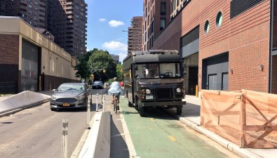
Shame Bike Lane Blockers — and City Hall — With This Interactive Map

A new web site lets people publicize incidents of motorists blocking NYC bike lanes. The developer hopes the site will draw attention to bike lane obstructions as a serious safety issue, leading Mayor de Blasio to devote more resources to improving bike infrastructure.
Cars in Bike Lanes allows users to upload photos of offending vehicles to an interactive map, along with time and location info, and a description of each incident. Posts are vetted before they go live. Clicking on the license plate number shows whether the motorist is a repeat violator.
Developer Nathan Rosenquist told Gothamist he developed the site in response to City Hall’s “lack of leadership” on keeping bike lanes free of cars. During a recent appearance on WNYC, Mayor de Blasio said it was OK for motorists to park in bike lanes in certain cases. But parking in bike lanes is illegal, and poses a safety risk regardless of driver intent. “I don’t think he understands that it takes a lot less time to be killed on a bike than it takes to let the kids off at home,” Rosenquist said.
Rosenquist said his map, which is based on OpenStreetMap, is “more complete than both the DOT’s 2016 [bike] map and Google Maps.”
Ultimately Rosenquist would like to collect enough data to pressure City Hall to build more protected bikeways and keep motorists out of painted lanes. “New York City’s streets and traffic management need radical permanent changes to stay sustainable,” he said.
