Waterfront Plan Provides Timeline for Greenway Expansions
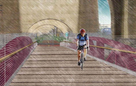
 The Randall’s Island Connector, part of the South Bronx Greenway, would run underneath an Amtrak trestle and create a new link to bike or walk between the South Bronx and Manhattan. Image: NYCEDC
New York City’s greenway system will see steady growth in the next three years, according to city plans released earlier this week. As part of its plans to revitalize the waterfront, the city released a list of 14 funded greenway projects slated to move forward in the next three years.
The city’s comprehensive waterfront plan encompasses everything from protecting water quality to supporting the working waterfront. For a sense of the city’s ten-year vision for its more than 500 miles of waterfront, take a look back at Streetsblog’s coverage the draft plan from September.
Included with the final report is something new: an action plan consisting of 130 funded projects on track for the next three years. Many of these projects have been in the works for a long time, but the list provides a clear roadmap of where these essential pieces of cycling infrastructure are headed during the remaining years of the Bloomberg administration. The Hudson River Greenway is the most heavily used bike path in the country, evidence of the importance of these safe and scenic routes.
Here’s the list, with the lead agency and estimated date for the project in parentheses:
- South Bronx: Complete improvements to the South Bronx Greenway. (EDC, 2012)
- Complete Bronx River Greenway improvements. (DPR, 2013)
- Brooklyn Bridge Park: Develop Brooklyn Bridge Park Greenway, linking the Columbia Street Greenway to DUMBO. (DOT/BBP, 2012)
- Brooklyn Navy Yard: Complete redesign of Flushing Avenue between Williamsburg Street West and Navy Street. (DOT, 2013)
- Red Hook: Build a multi-use path to connect Atlantic Basin to the Brooklyn waterfront greenway. (DOT, 2011)
- Sunset Park: Complete study of bicycle and pedestrian connection from Hamilton Avenue Bridge to 2nd Avenue and Sunset Park path. (DOT, 2011)
- Release Brooklyn Waterfront Greenway Master Plan, guiding creation of a 14-mile, multi-use waterfront path between Newtown Creek and the Shore Parkway Greenway. (DOT, 2011)
- Lower Manhattan: Complete construction of 8.5 acres of East River Esplanade South between Battery Maritime Building and Pier 35, including Pier 15, to feature water uses, educational uses, and café. (EDC, 2012)
- Randall’s Island: Complete waterfront pathways, including the Bronx Shore pathway, comfort stations, and seawall repairs. (EDC, 2013)
- Sherman Creek: Complete the Sherman Creek Waterfront Esplanade Master Plan to reclaim the Harlem River waterfront from Sherman Creek Inlet to W. 208th St. (EDC, 2011)
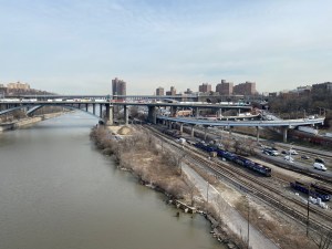
- Washington Heights: Restore the High Bridge over the Harlem River, and restore access paths within Highbridge Park to improve connectivity between Northern Manhattan and the Bronx. (DPR, 2011)
- Complete Manhattan Waterfront Greenway improvements, including Battery Bikeway, Dyckman Ramp, and a segment of the Lighthouse Link. (DPR, 2013)
- Fresh Kills: Construct portions of the new Greenway. (DPR, 2013)
- Stapleton: Begin construction of 6-acre waterfront esplanade. (EDC, 2011)
Conspicuously absent from this list are any projects in the city’s largest borough, Queens. Even so, if all goes according to plan, then New Yorkers, especially residents of the Bronx, will have far better greenway options in three years than they do today.

