Real-Time Bus Info Arrives Along the B63

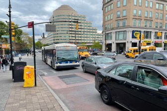
From the Verrazano to Brooklyn Heights, passengers on the B63 can now make their rides more predictable. As of today, the MTA has launched a new bus tracking system that enables riders to find the location of every bus on the route either online or by text message. For riders who can send texts or check the internet from their phones, there’s much less guesswork involved in determining, for instance, whether it will be faster to walk.
If the tracking system, which was developed as a low-cost, in-house solution, turns out to be a success, it will be expanded to the entire bus network on Staten Island as early as this year.
Until today, the only real-time bus info available to New York City riders was along 34th Street. As Ben Kabak explains, that system is proprietary and expanding it would lock the MTA into another inflexible, unaffordable contract.
The B63 tracking system, in contrast, was developed using an open-source model in collaboration with OpenPlans, Streetsblog’s parent organization. It collects data with onboard GPS devices, then analyzes and improves the data before publishing the bus locations.
Currently, the system can only calculate the distance between a bus and a given location, not the time until a bus arrives. To help speed the development of that functionality (and save money), the MTA is making all the bus location information open to the public. Any enterprising developer can enter the fray and create the algorithm that will help bring real-time bus arrival information to New Yorkers.


