DOT Promises Bus Improvements on Livingston St., Downtown Brooklyn’s Placard Abuse Epicenter
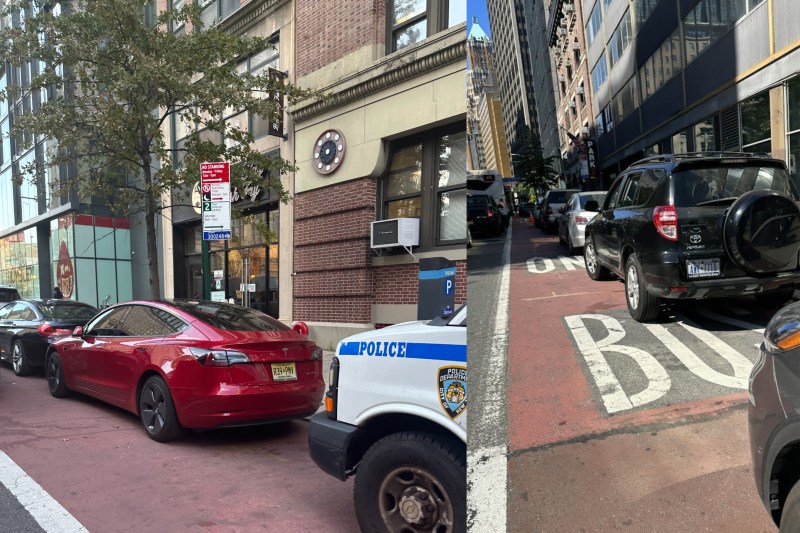

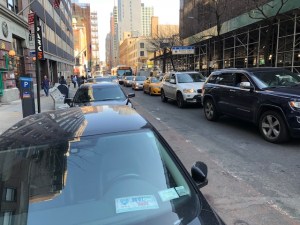
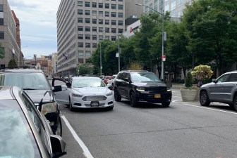
The city plans to overhaul the Livingston Street bus lane in Downtown Brooklyn next year to make commutes faster and more reliable for the 30,000 daily bus riders using the roadway, which is chronically blocked by drivers abusing parking placards and hogging the red-painted lanes.
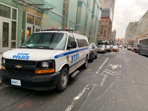
The Department of Transportation is looking at changes for the 0.55-mile section between Flatbush Avenue and Boerum Place, where there are currently bus lanes that are technically reserved for public transit on weekdays from 7 a.m.-7 p.m., but are instead filled with illegally parked cars because the rules are rarely enforced.
Bus speeds for the Metropolitan Transportation Authority’s four routes going through that stretch are as low as 5.7 miles-per-hour, slower than the borough-wide average of seven miles-per-hour, according to a DOT presentation officials shared with a community advisory board last week.

The B41 bus, for example, crosses the borough from the Kings Plaza Mall in Mill Basin, only to slow to a crawl once it gets to the Downtown Brooklyn end of its route (see map, right).
Livingston is one of five new bus priority projects Mayor Adams and MTA leaders announced in June. The others are Flatbush Avenue, Tremont Avenue in the Bronx, and upper Broadway and Second Avenue in Manhattan.
Help for Livingston is part of a recent city focus on Downtown Brooklyn. In 2020, the city barring through traffic on nearby Jay Street between Schermerhorn and Tillary streets — a scheme that increased bus speeds briefly, until illegal traffic chipped away at those gains last year amid a lack of enforcement.
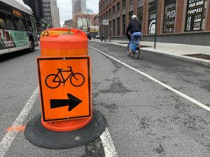
Parallel to Livingston, DOT turned Schermerhorn Street into a one-way street and painted a protected bike lane in the fall.
Like other parts of the downtown area, Livingston Street is lined with government offices — including the headquarters of MTA’s New York City Transit — and is a hotspot of people parking illegally with government placards (sometimes real, sometimes not) or other paraphernalia like vests, to avoid getting a ticket.
The Twitter account NYC Bike Lanes has repeatedly documented the issue on Livingston and adjacent thoroughfares, and told Streetsblog that a day doesn’t go by without the blatant corruption.
“I don’t think any buses have ever driven in the bus lane during the operating hours. If you get there when it opens at 7 a.m., it’s already lined up,” said the person behind the Twitter account, who declined to share their name citing past unwanted contact by the police.
DOT acknowledged in the presentation that the lanes are “consistently blocked” by placard parkers and commercial vehicles.
The agency included photos by the Twitter account in its presentation — and among the shots was one where a business had to set up metal gates and cones to keep their loading dock entrance clear of the cars!

DOT is working with the MTA on automated enforcement and transit signal priority, but beyond that, officials have not exactly zeroed in on specific redesigns yet.
The DOT is looking at busways like on Manhattan’s successful 14th Street conversion, or center-running bus lanes like on E. 161st Street in the Bronx.
The agency is also considering improving bus stops and pedestrian infrastructure like islands or more painted markings along the way.
Most pedestrian injuries along Livingston came from drivers turning and hitting people while they had the light to walk across, according to DOT, or 22 times out of the 41 pedestrians hurt in crashes between 2016-2020.
This year through November, there have been 40 crashes injuring 19 people, seven cyclists, six pedestrians, and six people in cars.
Community Board 2 has the eighth-highest traffic volumes in the city, and 68 percent of households live car free, according to data collected by Transportation Alternatives and MIT.
Advocates hoped that the city would focus better designs to discourage illegal behavior rather than relying on cops to keep scofflaws from hogging the red lanes.
“Individual enforcement against placard abuse is a failure and automation and design are the key tools that we need to speed up buses and stop drivers from blocking the lane,” said Danny Pearlstein of Riders Alliance.
The transit booster said busways and center-running bus lanes would be less likely fill up with people trying to park illegally.
“While placard abuse is rampant at the curb and even on the sidewalk, we haven’t yet seen placard abusers so brazen as to park their vehicles right in the middle of the road, turn them off, and leave and block traffic,” said Pearlstein.
DOT plans to work on a design over the winter and share it with the community board in February or March, before implementing it later that spring.
“DOT is excited to work with the local community to improve bus speeds and reliability for the 30,000 daily bus riders along Livingston Street. We are currently in the early planning process and expect to present a proposal next year.” Tomas Garita, an agency spokesperson.
