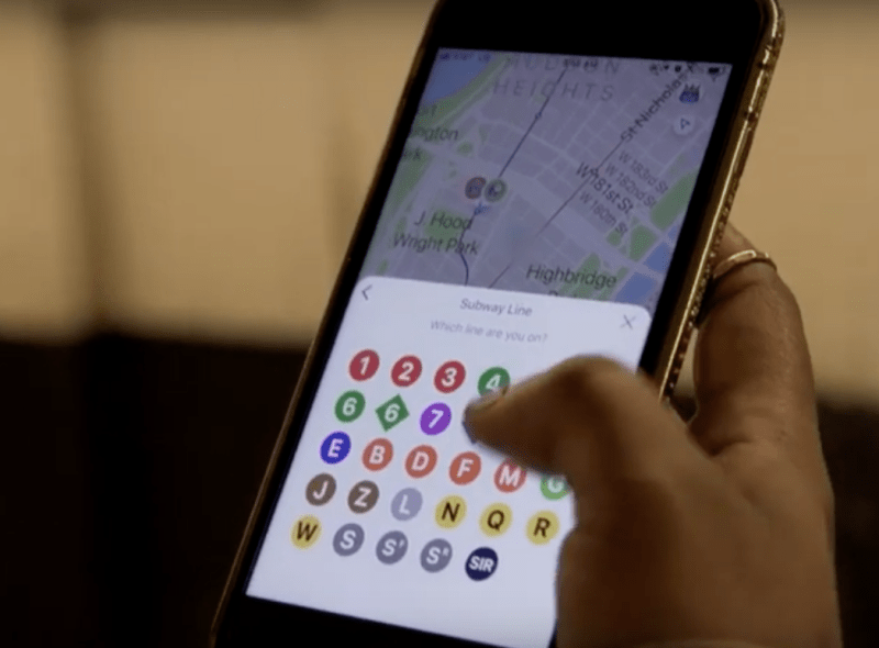
Meet Google Pigeon — A New App That Wants You to Help Others Get Around

You squalkin’ to me?
Google has quietly expanded its Pigeon app to better serve a lofty goals: telling New York commuters the best way to get to work.
The app, “which uses crowdsourcing to provide real time transit data,” launched last year with only subway information, but on Wednesday, Google announced that it now serves “all modes” of public transportation in New York City, including busses, commuter rail and ferries (ferries? Well… See below).

“With such a diversity of transit options in New York, we want to make it easier to find and provide real-time information for commuters,” said Laura Rokita, general manager of the Pigeon project, which is a creation of Google’s Area 120 “experimental” division. “By crowdsourcing reports about public transit, Pigeon seeks to make it easier for New Yorkers to figure out the best way to get from point A to point B in real-time.”
The app seamlessly organizes the city’s buses and subways into one central place, offering real-time data on the whereabouts of each bus or train. But Pigeon is more than just a map. Its main goal, it seems, is to provide users with personalized commute notifications and alerts based on what others are experiencing.
“BE A TRANSIT HERO,” the Pigeon website reads. “Report issues while riding the subway and join a growing community that helps keep NYC moving everyday.”
But in early testing on Wednesday, other anonymous pigeons — the fellow users who are providing bits of the crowdsourced information — weren’t that helpful.
“Delays (2-8 m),” wrote “anonymous” about a potential F train ride between Windsor Terrace and Park Slope. (Isn’t that line always delayed by roughly that amount of time?)
It’s also unclear how ready Pigeon is for New York. Another hypothetical commute from Windsor Terrace to Lower Manhattan declared a 46-minute walk, G train, A/C train, walk commute the “best” at 45 minutes (“all good,” the app said) even though the Pigeon algorithm also spit out a 36-minute version of the same commute, substituting the F train for the G train.
Pigeon does not sync with your contacts, so if you want train or bus directions to a friend’s house, you’ll have to manually enter in the address.
Pigeon also does not include Citi Bike locations, which would help users alert each other to NYPD stings. Here’s an irony: one Google arm apparently isn’t talking to its other Google arm. Yesterday, the tech giant announced it had incorporated bikes and taxis into its main map app, but neither appears in Pigeon.
Beyond directions, Pigeon’s “activity” tab yields a list of random commuters complaining about service all over the city.
At 8:41 a.m., a user named “DeezNutz” complained that a 5 train at Union Square was “overfilled.” At the same time, a user named “b.r.@.n.c.h.” complained that his A train at Broad Channel was “just waiting for something.” Bronx Bomber added a photo of some random backs that he snapped on his 5 train at 125th Street. “Getting tight here,” he or she wrote.
Clicking around on this part of the app leads a would-be subway or bus rider down a rabbit hole of every other commuter’s horrible experiences.

Consecutive posts at around 9 a.m. from the 7 train by “anonymous,” “Erascable,” “cocobelle” and another user revealed that the crucial Flushing to Hudson Yards line was experiencing delays at Woodside-61st, 40th St., and at Vernon Blvd.
Meanwhile, a user named Rick Smitty was loving a two-man guitar band that had set up shop at the Fourth Avenue station of the F train. (Is this useful information?)
Google said in its press release that Pigeon includes the city’s ferry system, but no data showed up on the Pigeon app on Wednesday. (Since it’s crowd-sourced, perhaps not enough people are riding the ferry right now.)
The city bus function is similarly flawed. Pick a location and, sure enough, Pigeon shows all of the buses in the area at the moment — but only shows their routes when you click on one of them. If you click the wrong one, you get information for an entirely different route.
After initial publication of this story, an MTA spokesman sent over the following statement to deflect any suggestion that the agency doesn’t itself provide maps with real-time data:
The latest and most accurate service change information including live one-on-one customer service is available on the MTA’s digital channels including the MYmta app, mta.info and Twitter, but we welcome any credible effort to give riders additional accurate information to supplement our tools. A foundation of the MTA’s digital strategy is to share open data with developers who are free to use it in innovative ways that are helpful to our customers. While we work to improve our own tools with in-house expertise and the Transit Tech Lab initiative, we also work closely with third parties to help their products be as accurate and up to date as possible.
