City Crowdsourcing Tool Could Help Cyclists During Snowy Commutes

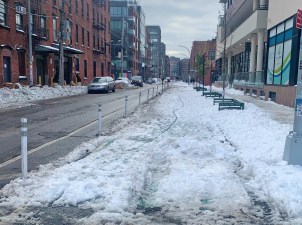
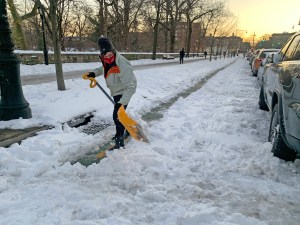
The weather’s given New York City a lot of opportunities to experiment with new responses to snow in the wake of the post-Christmas blizzard.
One potentially exciting new tool is a city attempt to crowdsource information about which streets are and aren’t clear of snow and ice. It could be a good resource for cyclists to share information about which bike lanes are clear and which remain unusable.
For cyclists, the site isn’t perfect. There’s no way to note whether park roads and greenways are plowed, only streets. Even so, for yesterday’s snow and future storms, it could turn out to be a useful platform for gathering and distributing info.
According to the city’s website, the snow conditions map isn’t intended for residents to inform the city of unplowed streets; use 311 for that. Rather, it’s a central site for people to warn others about where they can travel.