#StuckAtDOT: The Case of the Missing Crosswalk
A block in Astoria with a playground and a school lacks crucial pedestrian infrastructure. Why?

This is another installment of #StuckAtDOT, a campaign by Streetsblog’s parent company, Open Plans. The goal is to get the city agency to make improvements quickly and without unnecessary impediments.
Case study: Crosswalk requested.
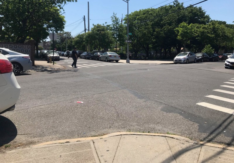
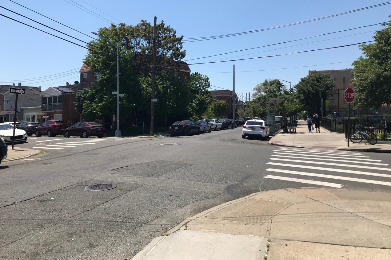
Location: 30th Road between 45th and 46th Street, in Astoria, Queens. This is a residential block, adjacent to the recently renovated Astoria Heights Playground and The Horace Greeley Middle School (I.S. 10). Currently, the streets lack a stop sign or crosswalks at all corners. Instead, where parents and kids need to cross, curb-cuts are often blocked by cars, creating accessibility issues and a dangerous line of sight.
Mitigating circumstance: None.
The key detail: The city is chock full of missing crosswalks; believe me, I request them all the time. When I requested the specific intersections above, the Department of Transportation responded that a traffic study was already underway. That’s where interventions fall into the trap of MUTCD, or the Manual on Uniform Traffic Control Devices, a series of U.S. DOT guidelines for street markings and traffic signals that critics argue is way too car-centric. (Advocates are hoping to change that because the first update to the manual since 2009 is underway.)
As a result, I received this response from the DOT: “This study will take into consideration several factors when determining whether existing conditions meet nationally recognized traffic safety engineering standards for traffic controls, including pedestrian and traffic volumes, crash data, roadway geometry, vehicle speeds and signal spacing.” Only one mentions actual humans. If there’s anything I learned in transport planning school, it’s that the field — up until very recently — cared about one thing: optimal vehicular traffic flow. Crosswalks be damned.
Stakeholder: None. (Or, I should say, everyone in the neighborhood.)
Initial steps: Given the commencement of a traffic study, it’s clear that I’m not the only person who has noticed the error and submitted a complaint. The park itself was renovated by the de Blasio administration and re-opened to the public in 2018. Its northeast corner, which lacks a crosswalk, recently received an on-street Citi Bike dock. Cars usually park right next to it.
Stuck at DOT? Yes. Unless MUTCD changes, the DOT abides. (According to the agency’s case status tracker, the traffic study is “pending” with no further update.)
Best practices: The DOT does have what it calls “Enhanced Crossings,” which are designated for areas exactly like this: “low-traffic areas near schools, parks, and libraries.” The agency has pedestrian signage, traffic medians, and daylighting measures. However, the shorter length of this street in question may disqualify it in the eyes of the agency. (In general, there are only a handful of these crossings in western Queens.)
But what I think of often are the United Kingdom’s “zebra crossings,” which are crosswalks, usually raised, with blinking lights where cars legally have to stop. (Abbey Road is probably the most famous one, which gave The Beatles ample time to walk across it.) They’re often sited near schools, commercial streets, green spaces, and the like. More recently, councils have gotten creative, using 3D shapes to make them stand out more to drivers.

Mandating zebra crossings near all parks and schools would be a big change for American traffic engineering, but all I’m asking for is a crosswalk. (And maybe a stop sign?)
John Surico (@JohnSurico) is a journalist and urban-planning researcher.


