Bayonne Bridge Bike-Ped Path Opens — With No Safe Way to Get There
The Goethals Bridge pathway, meanwhile, is set to open "in the coming weeks" — once the Port Authority and DOT figure out a safe route for cyclists.

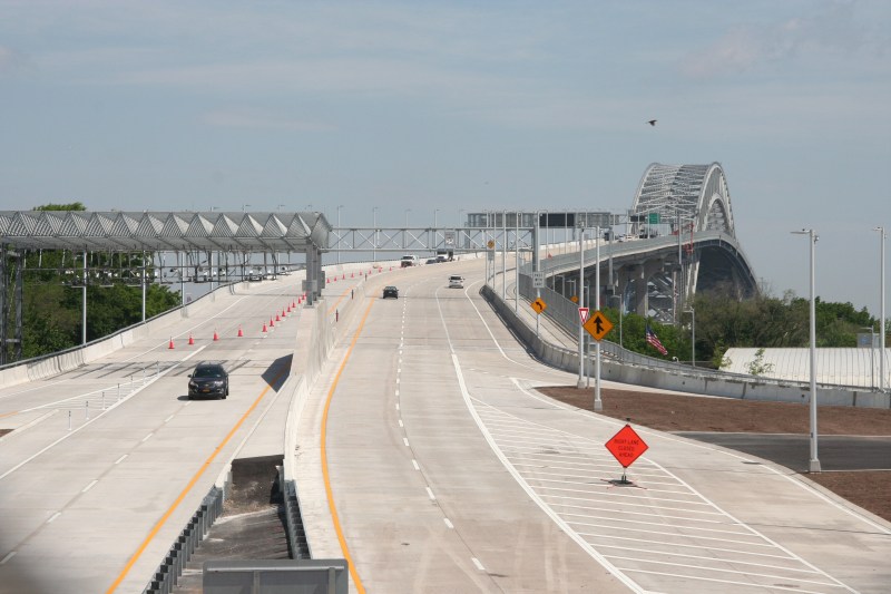
The Bayonne Bridge’s new bicycle and pedestrian path opened on Friday after nearly a year of delays — providing a non-auto link between Staten Island and New Jersey for the first time in six years.
The 12-foot-wide shared-use path connects Trantor Place in Staten Island to John F. Kennedy Boulevard in Bayonne. It’s the first time since the bridge’s former path was shuttered in 2013 that people can get off the Rock without a car or boat. The new path replaces a bike and ped route that was notoriously narrow with low railings.
“When I was in high school, I used to go on the old bridge all the time. The railings were super low, the path was a lot more narrow back then,” said Transportation Alternatives Staten Island organizer Rose Uscianowski.
For years, the Bayonne Bridge was the only way to get off of Staten Island by foot or by bike. That will change “in the coming weeks,” according to Port Authority spokesperson Steve Coleman, when a similar path opens on the Goethals Bridge, which connects Richmond County (aka Staten Island) with Union County (aka what people who trash talk New Jersey are typically talking about).
The Goethals pathway’s opening is delayed until the Port Authority and city DOT figure out a safe way for cyclists to access it, Coleman said. Its terminus currently opens out onto a three-lane one-way street that leads to a shipping terminal.

But accessing the Bayonne Bridge isn’t much better. The pathway opens onto Trantor Place: a two-way road with curbside parking and narrow sidewalks. Like every street in Staten Island, there are no protected bike lanes.
“In terms of infrastructure, there’s nothing. You feel like you’re in New Jersey,” said Uscianowski, who grew up in nearby Graniteville. “Coming from the bridge. There are no dedicated bike lanes. There are no paths at all.”

To improve conditions for cyclists, Uscianowski and other advocates of the so-called “Harbor Ring” greenway around New York Harbor have pushed for a greenway along the island’s North Shore [PDF] — either along Richmond Terrace or along rail tracks the MTA is considering using for bus rapid transit.
The Port Authority and DOT insist they’re working on it.
“We continue to work cooperatively with Bayonne and New York City to enhance the connections between our shared use path and the surrounding communities for those who cross the spans on foot or by bicycle,” Port Authority Chairman Kevin O’Toole said in a statement.
“We are excited about the new pedestrian and bike paths on the Bayonne Bridge and the Goethals Bridge,” said DOT spokesperson Lolita Avila. “We are currently developing plans and will continue to have discussions with Port Authority on how we can safely connect the paths to the street network.”
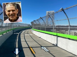
With Vince DiMiceli. An original version of this post suggested that DiMiceli’s hand appeared in one of the photos. That was not the case. In fact, it was a portion of a chain-link fence. Streetsblog regrets the error.


