This Might Just Be The Worst “Protected” Bike Path in the City
The Parks Department-overseen greenway from Third to Seventh avenues in Bay Ridge is classified as top-notch, but it is not.
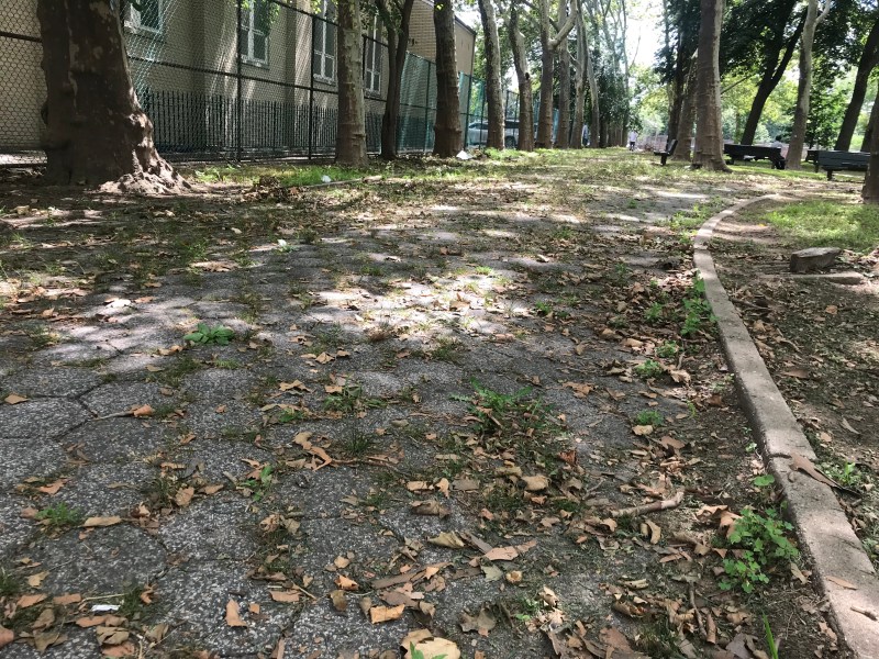
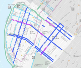
Officially, the cycling path through Leif Ericson Park in Bay Ridge is on the map as a “protected” bike lane — so why do I feel so uncared for?
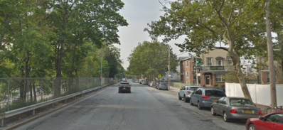
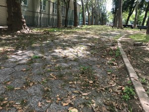
It’s probably because this bike lane is one of the worst in the city, with missing signs, missing curb cuts, potholes, bumps, garbage and directional signs that lead directly into parked cars.
And it’s particularly frustrating because the Department of Transportation is in the process of reconfiguring Wakeman Place to link this Parks Department-controlled disaster to the popular Belt Parkway bike path that stretches five miles along the harbor from Owls Head Park to Bensonhurst Park.
Locals have urged us to draw attention to the conditions along the path, so here’s our groundbreaking (or ground broken!) report:
From Ridge Boulevard to Third Avenue
This one-block stretch is not technically part of the Bike New York map, but it is Parks Department land and it is used by cyclists. Although why, we have no idea…
There’s no curb cut to allow for access, and the broken pavement is lined with garbage and, at least on Thursday, a man sleeping on a broken air conditioner. And without proper signs, it’s easy to think that the path wants cyclists to continue straight onto the Belt Parkway, which would not be a good move.
Oh, and there’s another TV in the same stretch!
From Third Avenue to Fourth Avenue
Street markings and signs direct cyclists onto this stretch, which is maintained only slightly better. A huge bump hides in the shadows…
And just before Fourth Avenue, the bike path turns into a sidewalk, with predictable results…

From Fourth Avenue to Fifth Avenue
Just when you start feeling that the city’s got your back, it reminds you that it doesn’t. Midway between the two avenues, the bike path intersects with a Belt Parkway approach road. There’s no curb-cut, crosswalk or anything else to alert drivers that pedestrians and cyclists are expected to cross here.
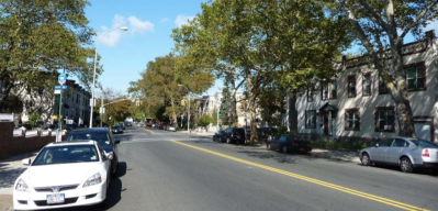
And there’s no “No Parking” sign to insure that cars don’t block what is mapped as a bike path but, in fairness to drivers, is not labeled as such on the street. With the cars parking along the street, the usable bike path goes from 10 feet to 10 inches wide…

From Fifth Avenue to Sixth Avenue
The bumpy pavement isn’t half bad, but there’s no curb cut on one side of Sixth Avenue, and no crosswalk to alert drivers to be safe.
Also, sharing what is supposedly a “protected” bike path with pedestrians is sometimes difficult…

From Sixth Avenue to Seventh Avenue
The pathway is so overgrown that it’s unsafe, as you can see in the lead image at the top of this story.
Plus, when you get to the end, the path ends abruptly, with parked cars and no curb cut. Perhaps it’s for the best, though: The bike path ends at the BQE service road.

An aide to Council Member Justin Brannan said the Bay Ridge Democrat is looking into constituent complaints about the path.
“If you look at the bike map, it makes it look this is a real bike lane,” said Chris McCreight. “But it’s not.”
An email to the Parks Department was not immediately answered. This story will be updated when it is.


