Google Bike Parking

bike_racks.jpg

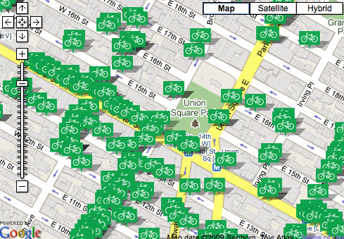
This is pretty neat: The Department of Transportation just released mapping data identifying the locations of more than 97 percent of the public bike racks in New York City. The data currently contains 5,968 of the 6,100 bike racks that have been installed as part of the DOT’s CityRacks program. The data is in .kml format, which can be displayed on Google Earth and similar applications.

ALSO ON STREETSBLOG

Digging Into the New Report on New York City Cycling

|
Where bike commuters live, according to Census data compiled by the authors of a new report on New York City cycling. As we mentioned yesterday, a team led by Rutgers professor John Pucher just released a major piece of research on the state of cycling, bike infrastructure, and bike safety in New York. If you […]

Weigh in on the Future of City Bike Racks

|
The 10 finalists in the CityRacks Design Competition, announced last March, are on the streets and ready for use, with prototypes installed in four of the five boroughs (sorry, Staten Island). Rack locations are mapped on the contest blog, where the city is accepting comments on each design. Nine of the prototype racks are also […]