A U.K. historian is on a quest to find and reclaim hundreds of miles of protected bike lanes built across his country in the early 20th century and then abandoned.
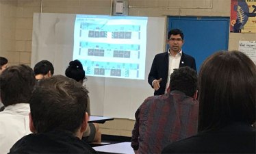
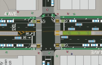
DOT reps brought the conceptual design for a redesign of Fourth Avenue with protected bike lanes to Sunset Park last night, following a similar event in Park Slope last week.
Last night, Queens Community Board 6 overwhelmingly endorsed DOT's plan to extend protected bike lanes, pedestrian safety improvements, and traffic-calming treatments on Queens Boulevard through Rego Park to Yellowstone Boulevard.
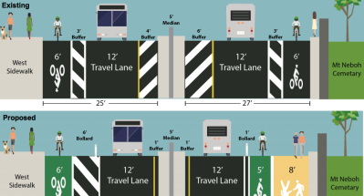
A dangerous street that connects Glendale to Ridgewood Reservoir, Highland Park, and two cemeteries is in line for traffic-calming and safer bike lanes thanks to a request from the local police precinct. Cypress Hills Street has a divided median and highway-like curves that do little to prevent motorists from speeding - it's an obstacle to good walking and biking access, despite its buffered bike lanes.
Last night, DOT presented the southern segment of its plan for a Seventh Avenue protected bike lane, from 14th Street to Clarkson Street [PDF], to the Manhattan CB 2 transportation committee, which voted for it unanimously.
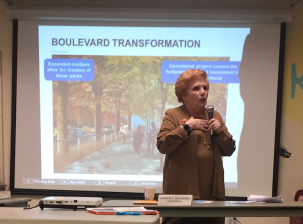
Fourth Avenue is far and away the most viable potential bike route linking Bay Ridge, Sunset Park, and Park Slope, but it's still scary to ride on, with no designated space for cycling. At 4.5 miles long, a protected bike lane would make the reconstructed Fourth Avenue one of the most important two-way streets for bicycle travel in the city, connecting dense residential neighborhoods to jobs and schools.